General overview of centres of action
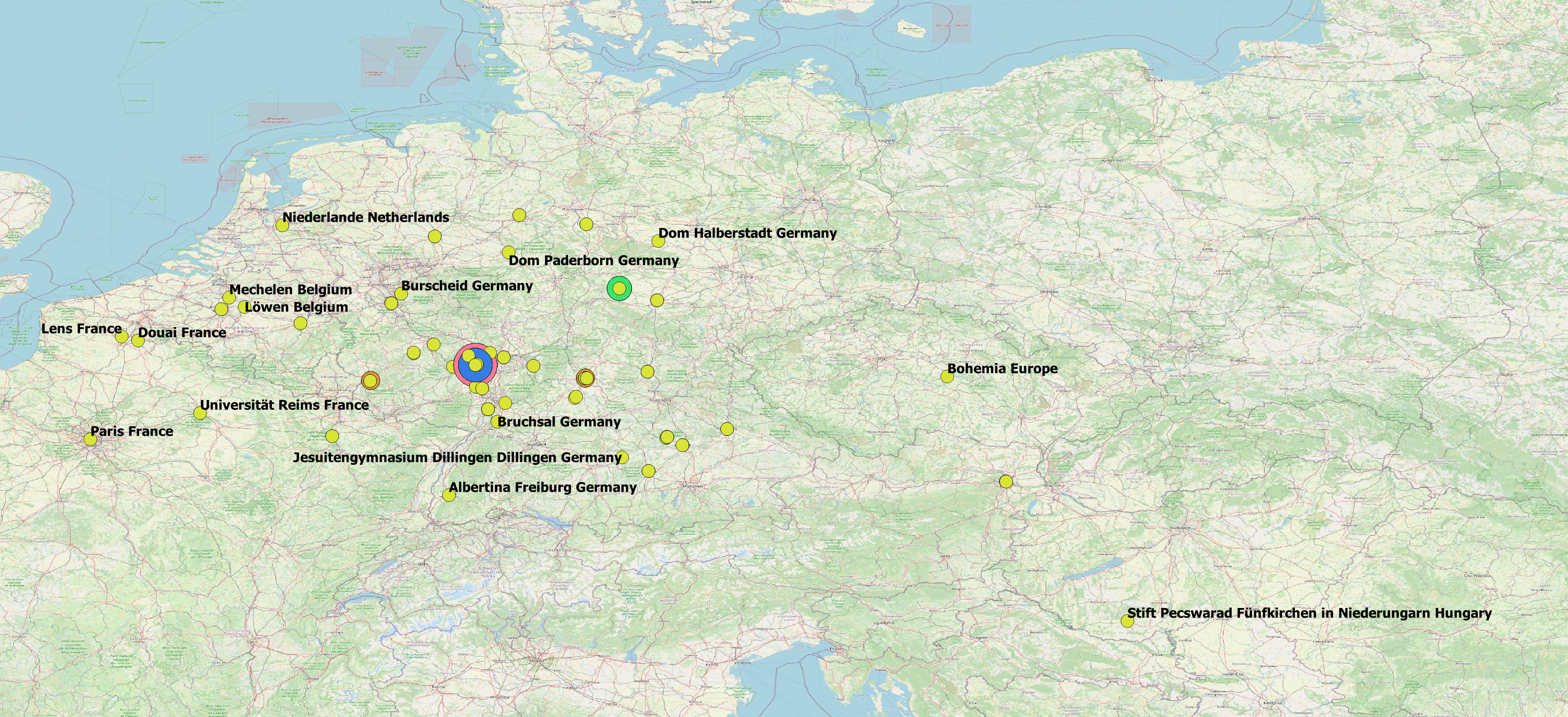
In the map above, point clustering is used to show the overall density of biographic events in the mapped places. Within the same city, places are differentiated by institution whenever possible and displayed as dots in different colours. The largest dots indicate place / institution names that are disproportionately frequent in the data.
The second map indicates the numerical frequencies of place names (mostly geocoded on institution level and clustered depending on zoom level). In absolute numbers, the cathedral of Mainz (Dom Mainz) is the most frequent place with 66 occurrences. In addition, there are several less prominent places (e.g. monasteries) within the city of Mainz. More than 20 places mapped as "Germany" in the centre of the present-day German Federal Republic denote biographic events for which the sources did not provide specific spatial information. In the map below, the placeholder dot for unknown places and five known places near the geometric centre of Germany overlap ("27"). In the map above, the placeholder is highlighted in light green. Missing or ambiguous spatial information as well as the high frequency of events within the present-day city of Mainz are challenges for cartographic representations of the collected data.
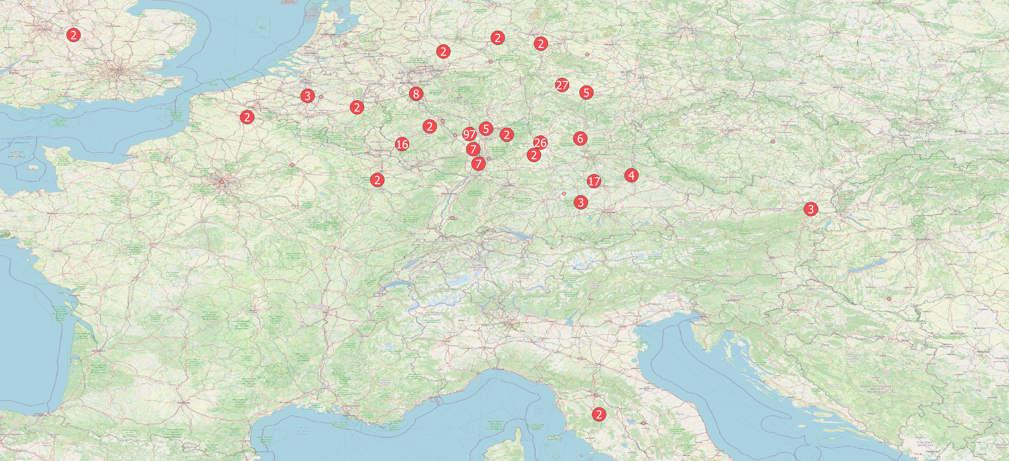
All geocoded places with 5 and more occurrences are listed in the table below. Spatial information in the original sources were mapped to these modern places to permit an automated geo-coding. As demonstrated in the point-cluster map above, unclear places (especially places of birth) were summarily mapped to "Germany" to include the events linked with them in visual representations at all. Therefore, the maps created in the project require contextualisation and a critical user engagement.